While Roudabush, Gale & Associates, Inc. is the oldest firm in the Charlottesville area, our staff excels in keeping abreast of changing laws and regulations and utilization of modern instrumentation and computer technology.

OUR CURRENT SERVICES INCLUDE:
ENGINEERING & LAND PLANNING:
Land Entitlements: Land Use/Zoning Plans and Applications
Stormwater Management and Erosion Control Plans
Stormwater Pollution Prevention Plans
Utility Plans- Water, Sanitary, and Storm Sewer
VSMP Permitting and Management
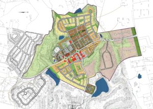
Subdivision Design and Planning
Industrial, Commercial, and Residential Site Plans
Construction Layout
Contract Document Preparation
Construction Management/Monitoring
Segmental Retaining Wall Design
Pipe Inspection Services
SURVEYING:
Physical (Mortgage) Surveys
ALTA Surveys
Topographic Surveys
Boundary Surveys
Geodetic Control Surveys
GPS Surveys
INSPECTIONS:
VSMP Inspections- SWPPP & ESC
Storm Water Management Facility Inspections
Mitigation Inspections
VWP Inspections
DRONE SERVICES
- DJI Phantom 4 RTK
- We use our DJI Phantom 4 RTK drone along with a smart ground control point and a dedicated service for processing and managing drone flight data to ensure a high level of accuracy and ease of access to information for our clients.
- 4 FAA 107 Commercial Drone Pilots on staff
- With multiple qualified drone pilots on staff, we can quickly response to survey requests.
- Topographic Information
- We provide aerial surveys which can provide accurate topographic information over large areas in a fraction of the time of traditional survey methods.
- 3D Measurements
- Our interactive, 3D aerial data allows us and our clients to take simple and complex measurements of the site, including but not limited to; stockpile measurements, basin volume measurements, slopes, and distances.
- Storm Damage Inspections
- Our aerial surveys can provide quick and thorough information following a storm event to help determine the extents of damage and provide time-stamped documentation for our clients.
- Visual inspections
- Our site inspections can provide a significant amount of information and valuable images of large and potentially difficult to maneuver areas without having to inspect the site on foot.
- Aerial Photography and Videography
- Although most of our flights are automated to ensure accuracy and consistency, we are also able to provide manual flights in order to capture photos and/or video at various heights and angles to meet our clients’ needs.
